The classes here are specifically aimed at the various tasks someone wanting to use or generate terrain information in their application. The code contains everything from a generic elevation grid creator to a fractal terrain generator.
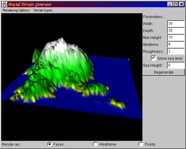
The image is of the example terrain generator demo application included as part of the CVS module. you can see the parameters used for the {@link org.j3d.geom.terrain.FractalTerrainGenerator} on the right. In addition to this, it is using a {@link org.j3d.geom.terrain.ColorRampGenerator color ramp filter} with the following heights set.
| Height | Colour |
|---|---|
| 0 | 0,0,1 |
| 0.2 | 1,1,0 |
| 1 | 0,0.6,0 |
| 3 | 0,1,0 |
| 8 | 1,1,1 |